Description
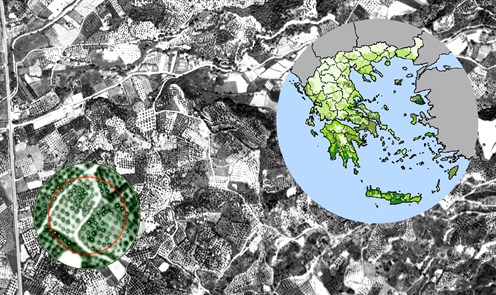
Aerial photos acquisition over the olives' production areas of the country, with a total extent of 55.000 km2.
Stratification of Greek territory through accounting the number of olive trees at Municipality level (statistical records). Design and implementation of a nation-wide sampling scheme.
Statistical selection: Primary (PSU) and Secondary (SSU) Sampling Units. Detection / digitization of 283.000 trees through photointerpretation. On the spot verification of the trees counting at 1.539 SSUs. Statistical estimates of the number (158 million) of trees at Country and Prefecture levels.